


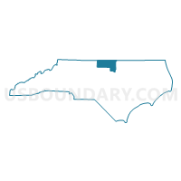
Granville, Person & Caswell Counties PUMA, North Carolina
About
Outline

Summary
| Unique Area Identifier | 193622 |
| Name | Granville, Person & Caswell Counties PUMA |
| State | North Carolina |
| Area (square miles) | 1,368.83 |
| Land Area (square miles) | 1,348.81 |
| Water Area (square miles) | 20.02 |
| % of Land Area | 98.54 |
| % of Water Area | 1.46 |
| Latitude of the Internal Point | 36.35292940 |
| Longtitude of the Internal Point | -78.96177220 |
Maps

Graphs
Select a template below for downloading or customizing gragh for Granville, Person & Caswell Counties PUMA, North Carolina


Neighbors
Neighoring Public Use Microdata Area (by Name) Neighboring Public Use Microdata Area on the Map
- Alamance County--Burlington City PUMA, NC
- Durham County (North)--Durham City (North) PUMA, NC
- Franklin, Vance & Warren (West) Counties PUMA, NC
- Orange County--Chapel Hill Town PUMA, NC
- Rockingham & Stokes Counties PUMA, NC
- Southside Planning District Commission & Commonwealth Regional Council PUMA, VA
- Wake County (Northeast)--Raleigh City (Northeast), Wake Forest & Rolesville Towns PUMA, NC
- Wake County (Northwest)--Raleigh City (Northwest) & Morrisville Town PUMA, NC
- West Piedmont Planning District Commission PUMA, VA
Top 10 Neighboring County (by Population) Neighboring County on the Map
- Wake County, NC (900,993)
- Durham County, NC (267,587)
- Alamance County, NC (151,131)
- Orange County, NC (133,801)
- Rockingham County, NC (93,643)
- Pittsylvania County, VA (63,506)
- Franklin County, NC (60,619)
- Granville County, NC (59,916)
- Vance County, NC (45,422)
- Danville city, VA (43,055)
Top 10 Neighboring County Subdivision (by Population) Neighboring County Subdivision on the Map
- Wake Forest township, Wake County, NC (65,491)
- Danville city, Danville city, VA (43,055)
- Oak Grove township, Durham County, NC (39,856)
- Reidsville township, Rockingham County, NC (19,874)
- Dutchville township, Granville County, NC (17,725)
- Roxboro township, Person County, NC (15,284)
- Youngsville township, Franklin County, NC (14,423)
- Brassfield township, Granville County, NC (12,180)
- Dan River district, Pittsylvania County, VA (9,491)
- Westover district, Pittsylvania County, VA (9,011)
Top 10 Neighboring Place (by Population) Neighboring Place on the Map
- Danville city, VA (43,055)
- Oxford city, NC (8,461)
- Roxboro city, NC (8,362)
- Butner town, NC (7,591)
- Creedmoor city, NC (4,124)
- Yanceyville town, NC (2,039)
- Rougemont CDP, NC (978)
- Stem town, NC (463)
- Stovall town, NC (418)
- Ruffin CDP, NC (368)
Top 10 Neighboring Unified School District (by Population) Neighboring Unified School District on the Map
- Wake County Schools, NC (900,993)
- Durham Public Schools, NC (267,587)
- Alamance-Burlington Schools, NC (151,131)
- Rockingham County Schools, NC (93,643)
- Pittsylvania County Public Schools, VA (63,506)
- Franklin County Schools, NC (60,619)
- Granville County Schools, NC (59,916)
- Orange County Schools, NC (49,938)
- Vance County Schools, NC (45,422)
- Danville City Public Schools, VA (43,055)
Top 10 Neighboring State Legislative District Lower Chamber (by Population) Neighboring State Legislative District Lower Chamber on the Map
- State House District 40, NC (125,208)
- State House District 31, NC (91,274)
- State House District 64, NC (80,704)
- State House District 32, NC (79,540)
- State House District 49, NC (77,779)
- State House District 55, NC (73,704)
- State House District 50, NC (73,491)
- State House District 60, VA (72,146)
- State House District 61, VA (71,425)
- State House District 63, NC (70,427)
Top 10 Neighboring State Legislative District Upper Chamber (by Population) Neighboring State Legislative District Upper Chamber on the Map
- State Senate District 15, NC (200,862)
- State Senate District 26, NC (196,857)
- State Senate District 15, VA (191,067)
- State Senate District 7, NC (186,929)
- State Senate District 19, VA (186,272)
- State Senate District 20, NC (181,624)
- State Senate District 24, NC (174,850)
- State Senate District 23, NC (173,265)
Top 10 Neighboring 111th Congressional District (by Population) Neighboring 111th Congressional District on the Map
- Congressional District 4, NC (826,878)
- Congressional District 13, NC (753,104)
- Congressional District 2, NC (741,576)
- Congressional District 6, NC (714,412)
- Congressional District 5, VA (685,859)
- Congressional District 1, NC (635,936)
Top 10 Neighboring Census Tract (by Population) Neighboring Census Tract on the Map
- Census Tract 539, Wake County, NC (7,605)
- Census Tract 9706.02, Granville County, NC (7,583)
- Census Tract 18.01, Durham County, NC (7,123)
- Census Tract 9205, Person County, NC (6,984)
- Census Tract 9201, Person County, NC (6,834)
- Census Tract 9202, Person County, NC (6,749)
- Census Tract 413, Rockingham County, NC (6,737)
- Census Tract 108.02, Pittsylvania County, VA (6,369)
- Census Tract 21, Durham County, NC (6,362)
- Census Tract 9610, Vance County, NC (6,315)
Top 10 Neighboring 5-Digit ZIP Code Tabulation Area (by Population) Neighboring 5-Digit ZIP Code Tabulation Area on the Map
- 27587, NC (53,078)
- 27320, NC (39,351)
- 27217, NC (36,954)
- 27704, NC (34,517)
- 24541, VA (28,221)
- 27302, NC (26,412)
- 27565, NC (25,255)
- 27537, NC (24,319)
- 27596, NC (15,619)
- 27574, NC (14,373)